Maps / Product design / Tool
route
canvas.
Draw something.
Then run it.
A tool that fits a drawing to real streets and turns it into a running route, ready to export for Strava or Google Maps.
Private tool · Not yet publicly hosted
From a line
drawing to a loop.
Upload a drawing, a photo or an SVG. Choose a start and finish, set a maximum distance between 0.5 and 50 km, and add up to eight stops in the order you want to reach them.
Route Canvas fits the drawing onto mapped pavements and paths and shows how closely the route follows it. The outline can be edited, moved, resized, rotated or mirrored before the route is made.
The finished route downloads as a GPX file for Strava, a KML file for Google My Maps and Google Earth, or a full pack with an offline map and a segment-by-segment audit.
The first test.
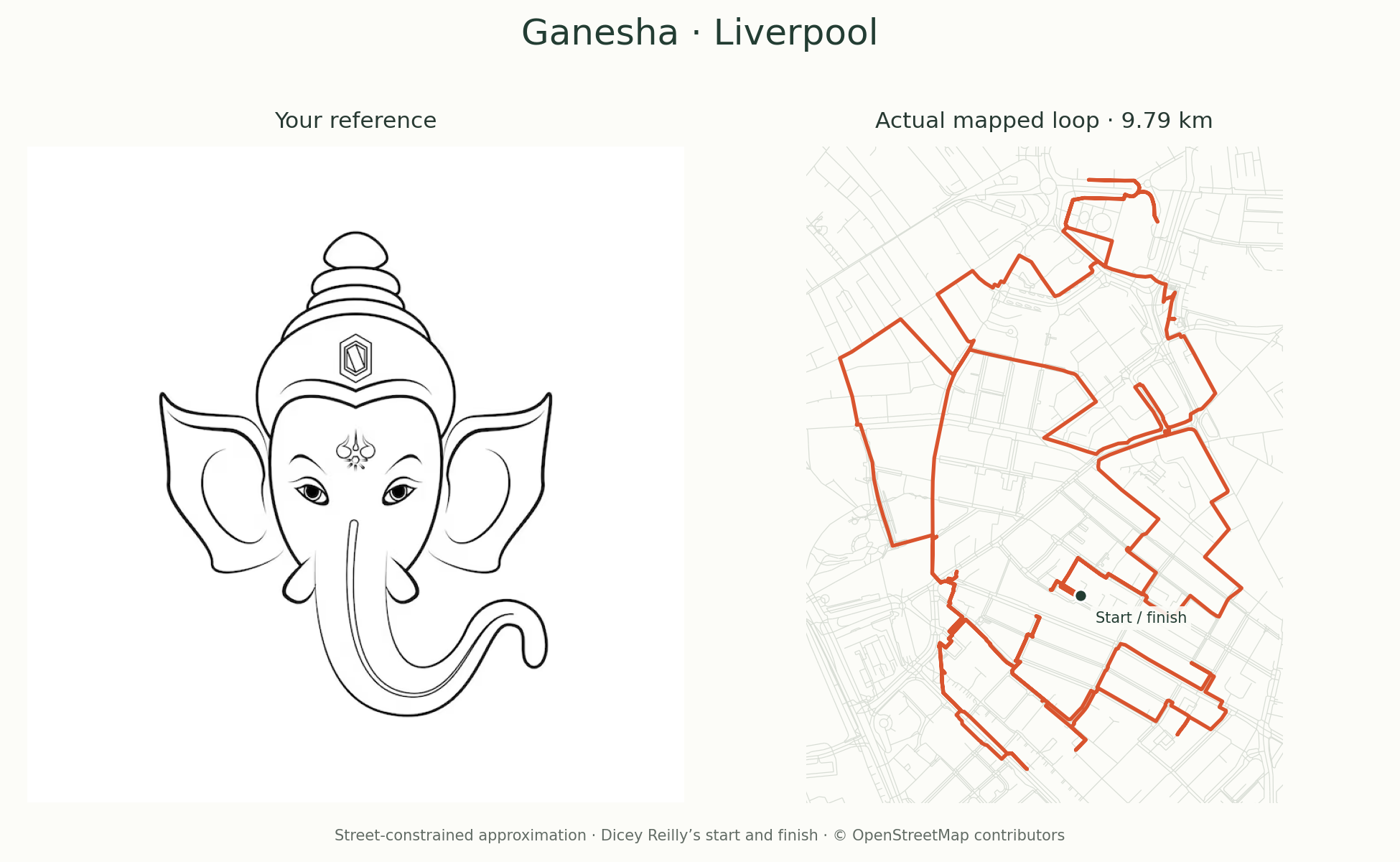
A drawing, fitted to Liverpool.
A drawing of Ganesha became a 9.79 km loop through Liverpool city centre. It was turned about 17 degrees to fit the streets. The crown, ears, head and curled trunk survive. The eyes and jewellery do not, because streets cannot draw that finely.
About 1.95 km runs over streets already covered, on purpose, to complete the shape.
Checked before it leaves.
Each of the route's 727 segments follows connected, mapped ways from OpenStreetMap. Private paths, building interiors, escalators and restricted gates are left out. Stairs are counted and flagged.
If a drawing cannot be made from the available streets, the tool says so rather than inventing a connection.
The limits
Map checks,
not a promise.
Map data can be incomplete, and streets close. The Ganesha route has not yet been walked or run.
Anyone using a route should follow current signs, keep to pavements and safe crossings, and never cross a barrier to save the shape.